Hiking the Rif Mountains
Morocco's Green North
The Rif Mountains stretch across northern Morocco near the Mediterranean coast, forming a distinctly different landscape from the arid south. This is the country's greenest, wettest mountain region, cloaked in cork oak, cedar and unique Moroccan fir forests, with peaks rising to around 2,456 metres at Jbel Tidirhine.
Lower and more humid than the Atlas, the Rif feels almost Mediterranean, with rolling forested ridges, rivers and waterfalls. The cultural and visual gateway is Chefchaouen, the famous blue-painted town tucked into the foothills, from which most hikes begin.
Chefchaouen as a Base
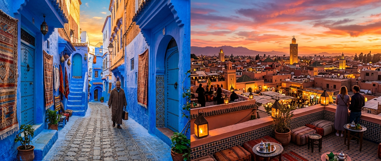
Chefchaouen, with its iconic blue-washed medina, is the launch point for Rif hiking. The town itself sits at the foot of the mountains, and several rewarding walks start directly from its edge, including the short climb to the Spanish Mosque viewpoint overlooking the blue city at sunset.
Beyond day walks, Chefchaouen offers comfortable guesthouses, good food and easy logistics, making it the ideal hub for exploring the surrounding peaks and the nearby Talassemtane National Park. Its relaxed atmosphere suits walkers who want to combine hiking with town life.
Talassemtane National Park
Talassemtane National Park protects much of the central Rif, including the rare Moroccan fir forests found almost nowhere else. Its trails wind through dense woodland, limestone ridges and dramatic gorges, with abundant birdlife and Barbary macaques.
The park offers a network of walks from gentle valley strolls to more demanding ridge hikes. It is the heart of serious Rif trekking, and longer routes can link Chefchaouen with remote villages and the park's signature natural features over several days.
The Akchour Waterfalls
The most popular hike in the region leads to the Akchour waterfalls, a short drive from Chefchaouen. The trail follows a river upstream through a lush gorge to a series of cascades and turquoise pools, with the option to continue to the natural rock arch known as God's Bridge (Pont de Dieu).
Akchour is a manageable day hike suitable for most fitness levels, with cafes en route and refreshing swimming spots in summer. Its accessibility and beauty make it the single most visited walk in the Rif, so early starts help avoid the midday crowds.
Culture and Local Life
The Rif is home to the Riffian Berbers, with a culture, dialect and history distinct from the Atlas. Hiking here passes through traditional villages, olive groves and farmland, offering insight into rural northern Morocco well off the standard tourist circuit.
Local guides enhance both safety and understanding, particularly on remoter routes. Visitors should be aware that the region has a long association with cannabis cultivation in certain areas; sticking to established trails and using reputable guides keeps hikes straightforward and trouble-free.
When to Hike the Rif
Spring and autumn are ideal, with mild temperatures, green landscapes and flowing waterfalls. April to June and September to November offer the most comfortable conditions for walking the forested ridges.
Summer is hot and busy, especially at Akchour, though the shade and river make it bearable. Winter can be cold, wet and occasionally snowy on the highest peaks, with muddy trails, so it is the least favoured season for serious hiking.
Practicalities and Access
Chefchaouen is reached by road from Tangier, Fez or Tetouan, with no airport of its own. Day hikes like Akchour and the Spanish Mosque can be done independently, while longer Talassemtane treks benefit from a local guide for route-finding.
Bring proper footwear for rocky and sometimes muddy trails, plenty of water for hot days, and a swimsuit for the waterfall pools. Carry cash, dress respectfully in villages, and check weather in winter when conditions can turn wet and cold quickly.
| Detail | Information |
|---|---|
| Highest peak | Jbel Tidirhine, approx. 2,456 m |
| Main base | Chefchaouen |
| Key park | Talassemtane National Park |
| Top day hike | Akchour waterfalls |
| Climate | Green, humid, Mediterranean |
| Best season | Spring and autumn |
Rif Mountains hiking at a glance
FAQ
What is the most popular hike in the Rif Mountains?
The Akchour waterfalls hike, a short drive from Chefchaouen, is the most popular. It follows a river through a gorge to cascades and pools, with an optional extension to the God's Bridge rock arch.
How high are the Rif Mountains?
The Rif reaches around 2,456m at Jbel Tidirhine, lower than the Atlas. The range is greener and wetter, with forested ridges, and a milder Mediterranean climate near the northern coast.
When is the best time to hike the Rif?
Spring (April to June) and autumn (September to November) are ideal, with mild weather and flowing waterfalls. Summer is hot and crowded, while winter can be cold, wet and muddy.
Loved this? Useful? React below — your feedback helps other readers.